Note: All photos can be seen at higher resolution by downloading. In most browsers this is accomplished by right-clicking on the photo and then selecting an option such as "Save Picture As" (Windows) or "Save Image to" (Mac OS X). With a single button mouse, control-clicking (holding the CTRL key while clicking) usually is equivalent.
This flight started from my home base at Hayward, CA and terminated at Tonopah, NV, midway between Las Vegas and Reno. All photos on this flight are courtesy of my copilot Simon Hackett, and were taken over Yosemite National Park.
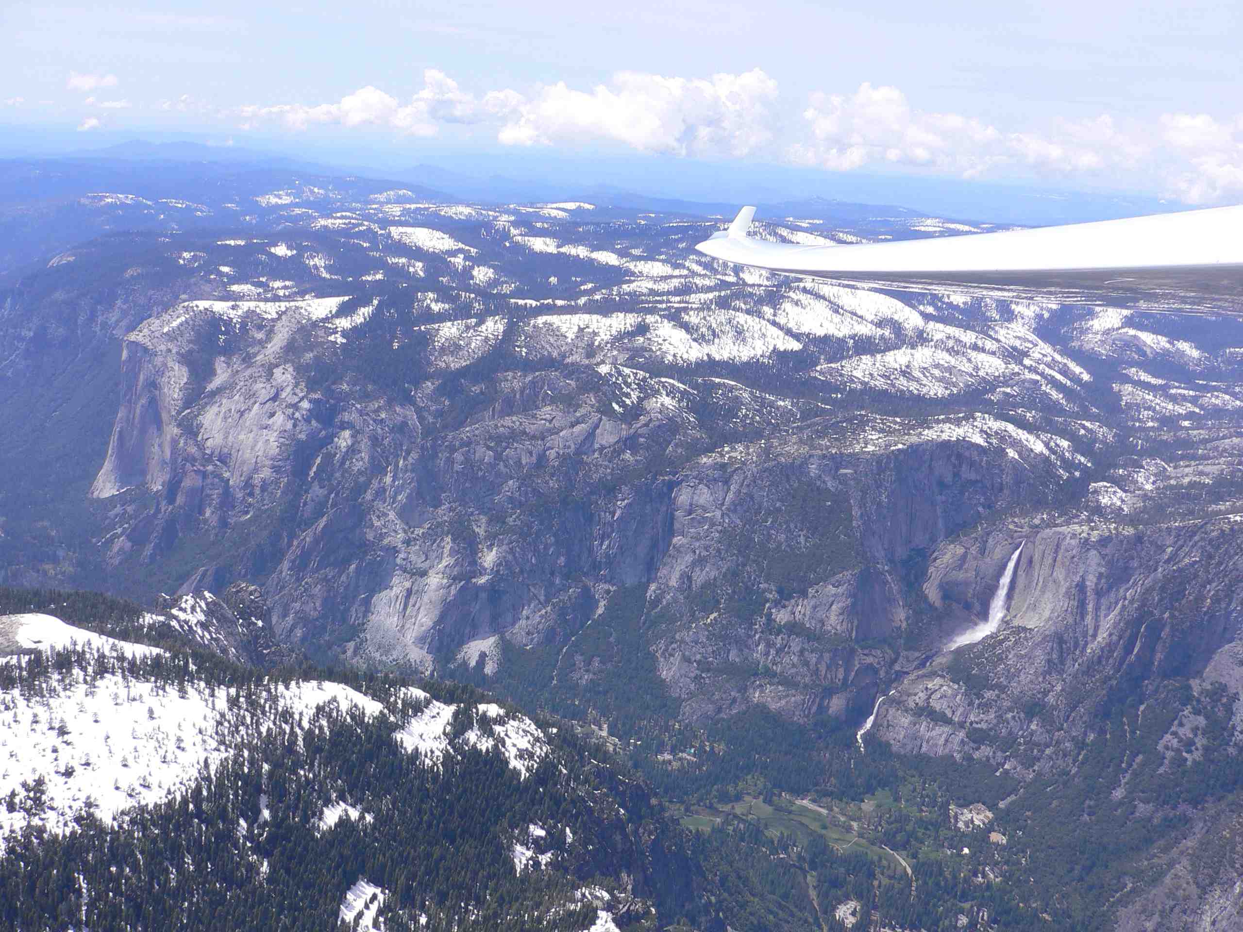
El Capitan and Yosemite Falls from 11,600'. The road through Yosemite Valley can be seen at the bottom of the falls. Snowfall the previous winter had been significantly above average, creating heavy flow in the falls and leaving a snow cap on more terrain than usual for this time of year. Water flow is almost entirely from snow melt and, when I visited the area later in September, there was no visible water in Yosemite Falls. Some of the other falls, such as Bridalveil, whose source creeks flow over more porous ground still had some water. In contrast, Yosemite Creek flows mostly over granite and cannot store water for the dry season.
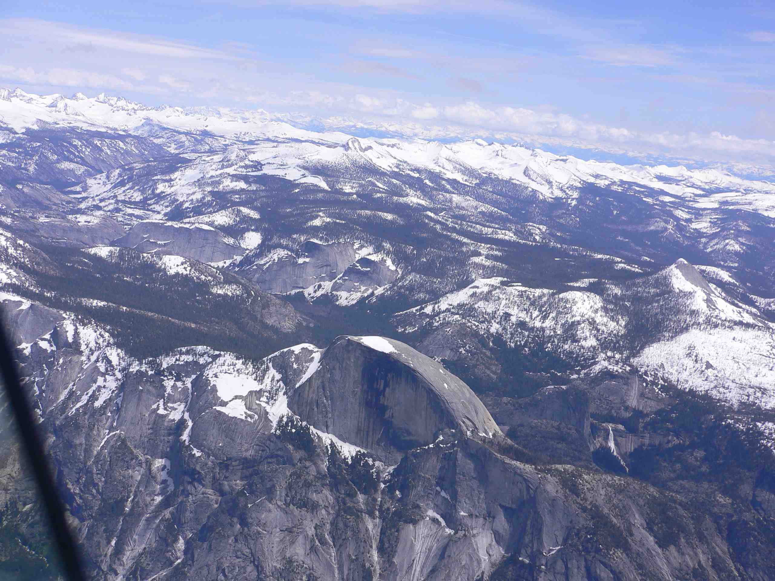
Half Dome and Nevada Falls seen from 12,800' with the high country in the east end of the park in the distance. At 8,842' Half Dome is the highest peak surrounding the Valley, while Mt. Dana in the eastern end of the park is significantly higher at 13,053'. Most visitors to Yosemite only visit the Valley, but the high country offers its own rewards including many fewer people. On a summer weekend the popular trails accessible from the Valley are wall-to-wall people, while the high country is sparsely populated.
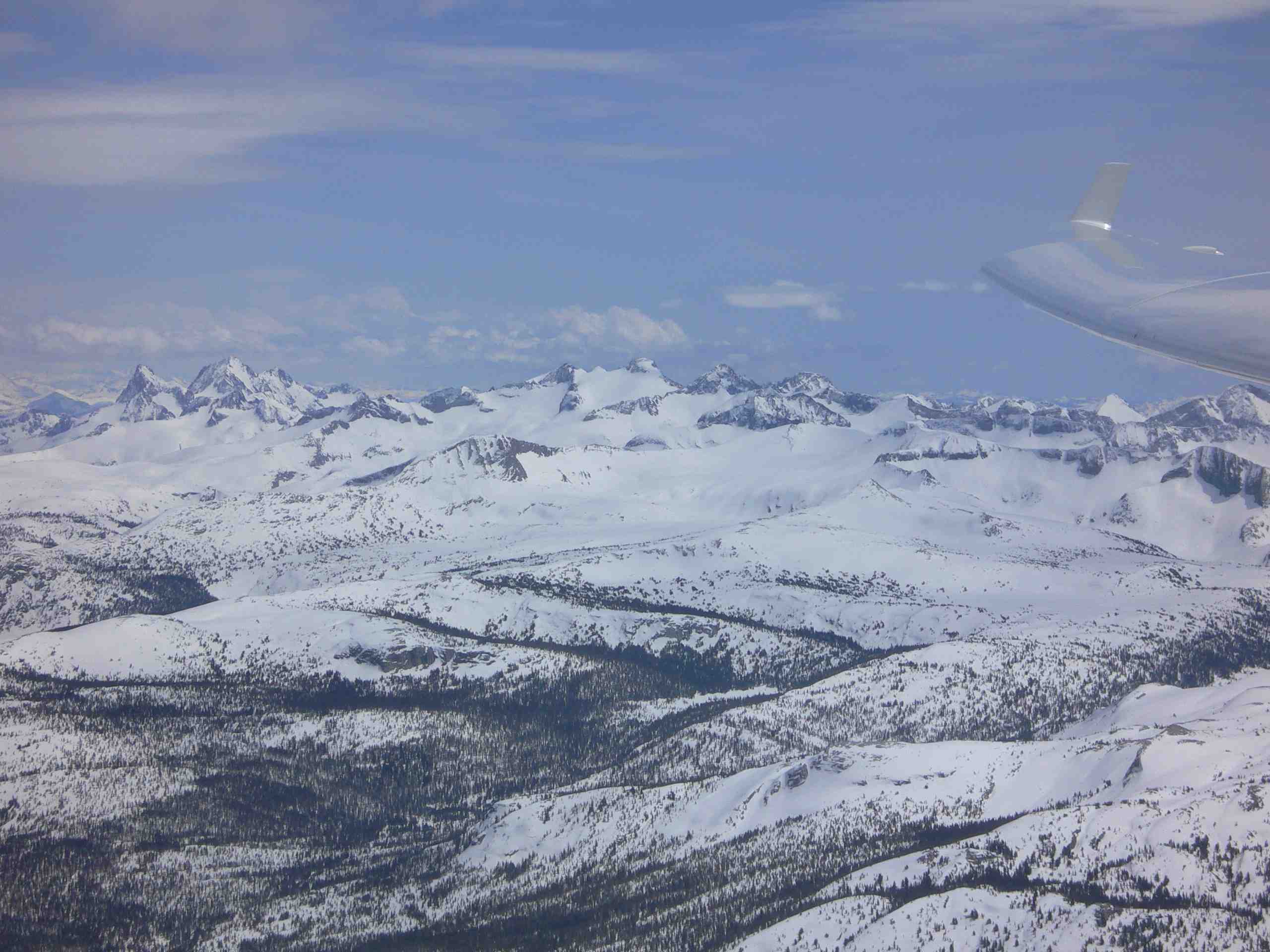
Over Tuolumne Meadows, looking south from 13,300'. At over 8,000' Tuolumne Meadows is higher than most peaks in the western end of the park.
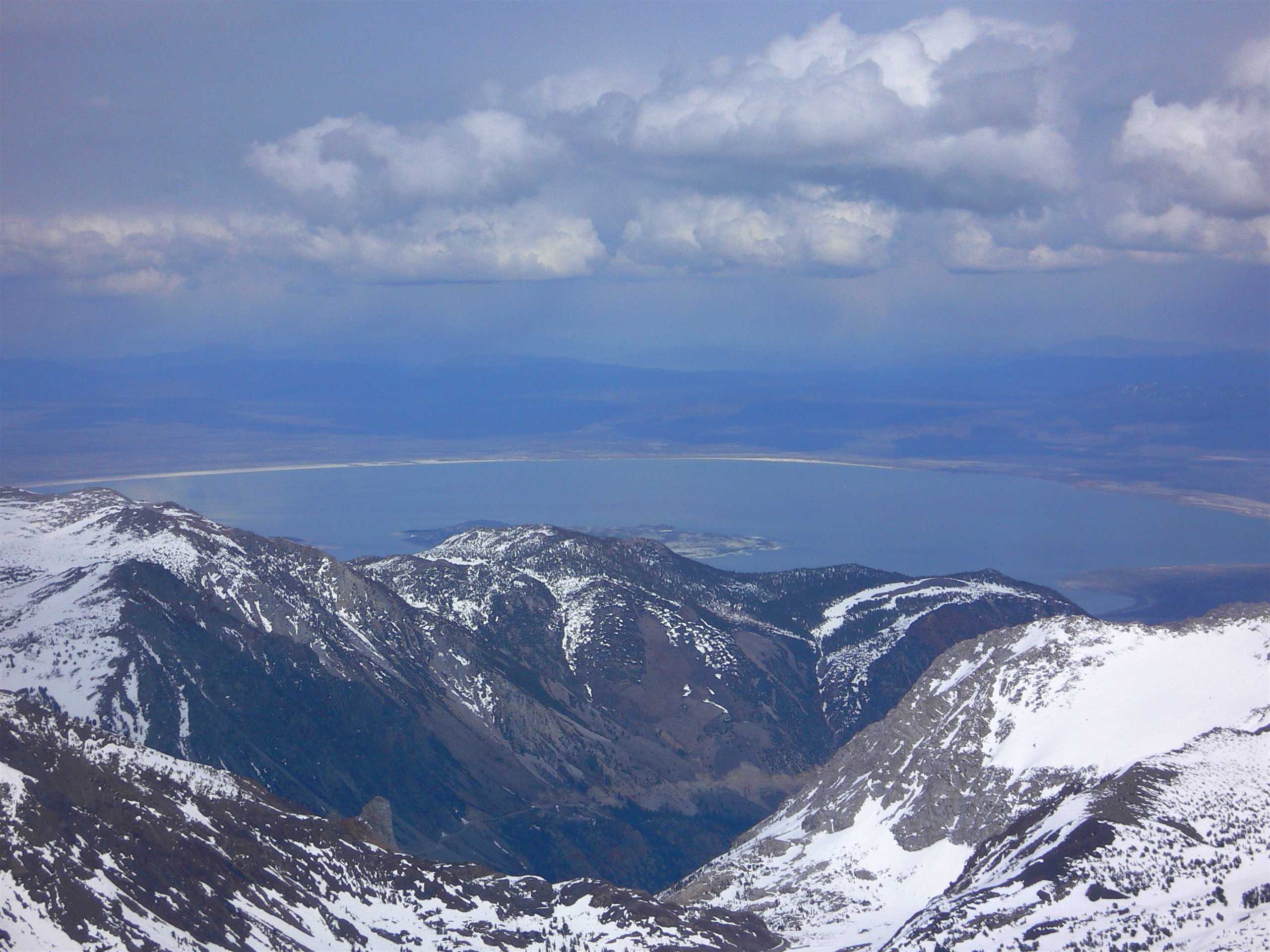
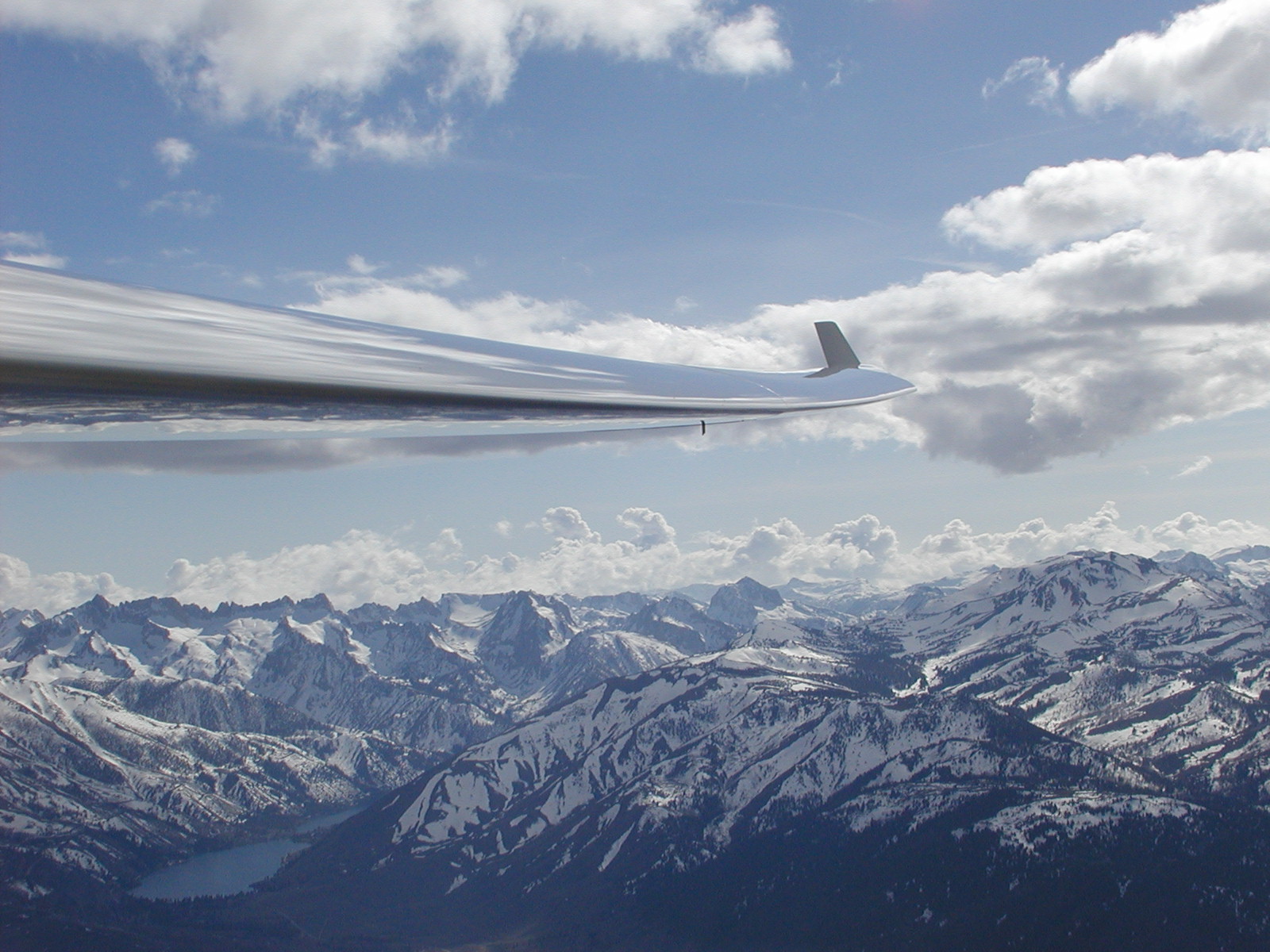
Mono Lake and Tioga Pass Road from 14,000'. This photo was taken from a thermal that gained us 2,000' of altitude in 5 minutes. Location is approximately 3 miles WNW of the Tioga Pass entrance to Yosemite and 3 miles SSE of Mt. Conness.
Leaving Tioga Pass, looking south from 14,500'. Grant Lake is partly visible at the left of the picture with a cumulus cloud street in the distance.
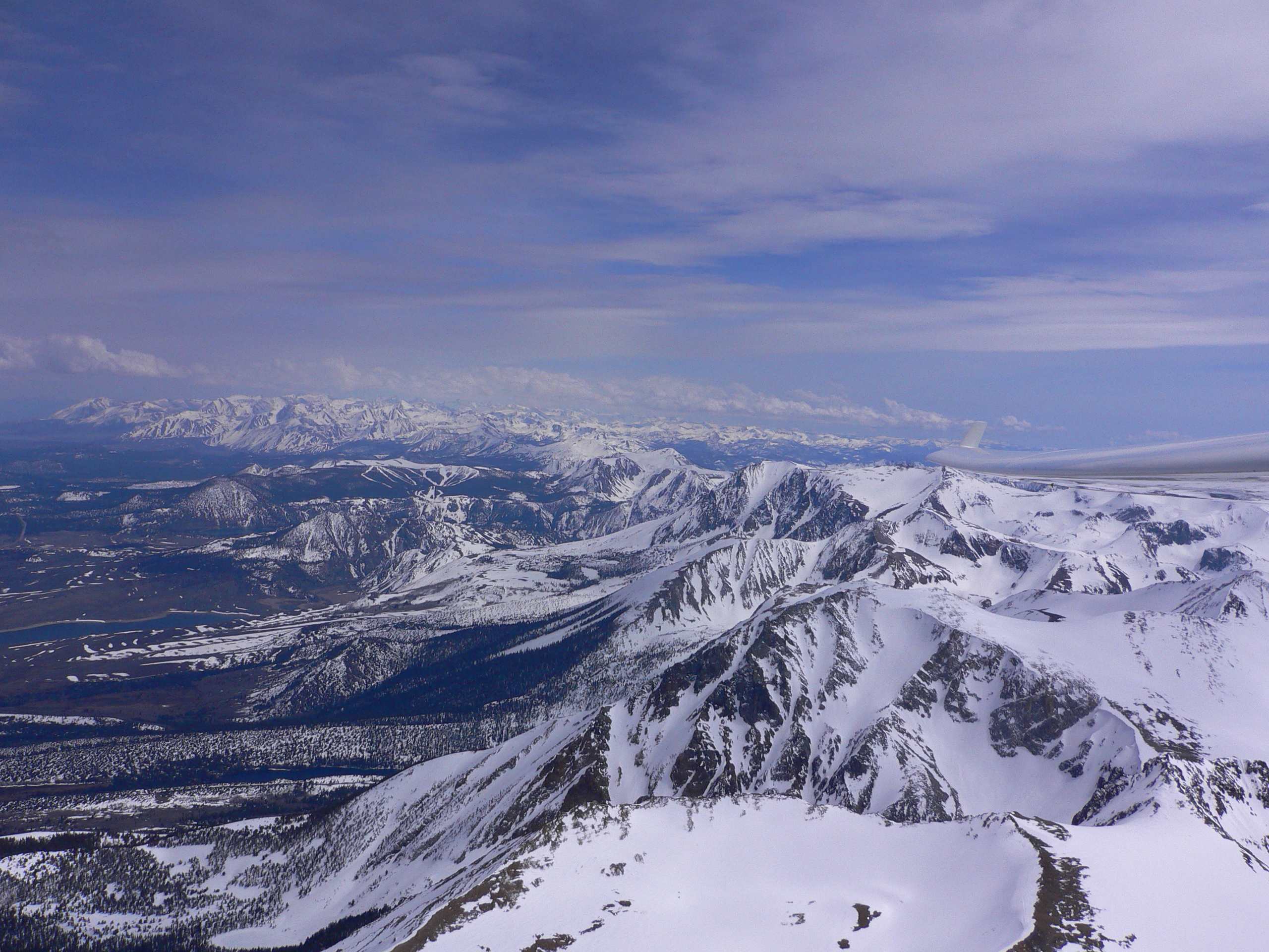
Twin Lakes, in the Hoover Wilderness Area just north of Yosemite on the East side of the Sierras and about 10 miles southwest of Bridgeport, California. This photo was taken on April 7, 2002, on a different flight from the other five pictures. It is included here since the time of year and snowpack are approximately the same. There are many "Twin Lakes" in the world and, even in this area, there is a much smaller Twin Lakes near here, which can be seen in the September 12, 2003 photo sequence, accessible form the "Return to Soaring Photo Links Page" below.
Return to Soaring Photo Links Page
Return to Martin Hellman's Home Page