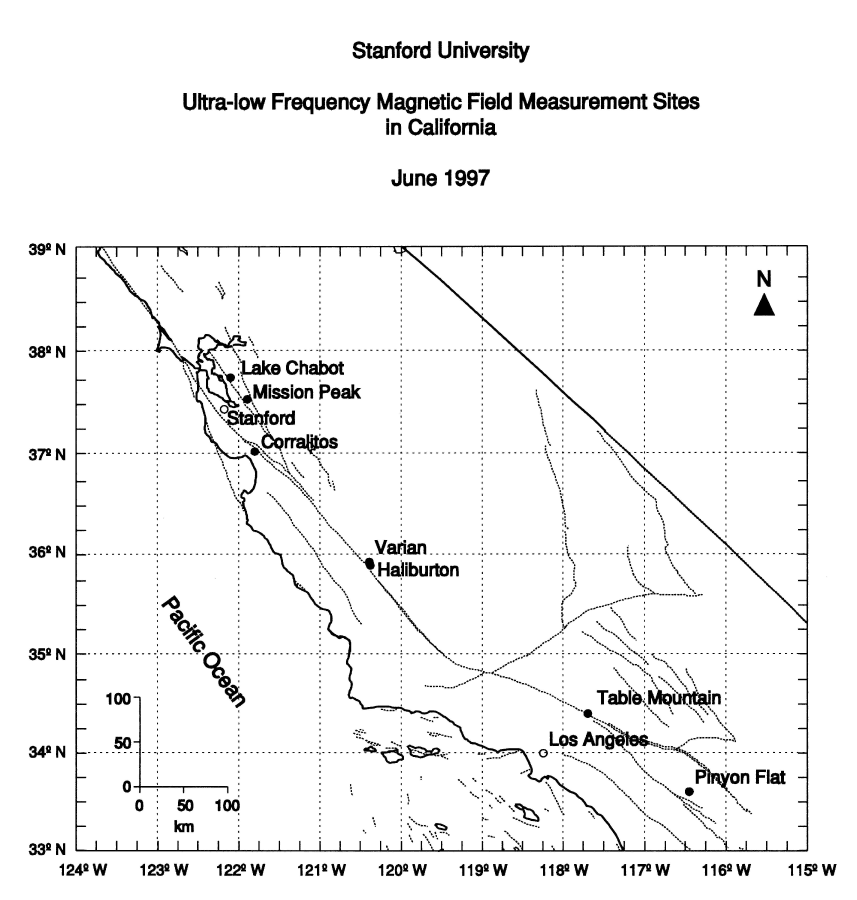
This map of California shows the Stanford field sites as solid circles and some of the most notable faults as dotted lines. The Lake Chabot and Mission Peak sites are on the Hayward fault in the San Francisco Bay area. Corralitos is located just south of the San Francisco Bay area on the San Andreas fault and within a few miles of the epicenter of the M7.1 Loma Prieta earthquake that occurred in October 1989. The Varian and Haliburton sites are located on either side of the little town of Parkfield, the "Earthquake Capital of the World," and Table Mountain and Piñon (Pinyon) Flat are both located in southern California. Table Mountain is close to Wrightwood, where a M7 earthquake occurred in 1812. All of these sites are either on or close to the San Andreas fault - the dotted line linking the various sites. The part of California to the left of the San Andreas is moving north-westwards relative to the part of California to the right of the fault. Obviously the big bend in the San Andreas to the north west of Los Angeles is an impediment to smooth motion along the fault.
[Return to research page , or home page.]